

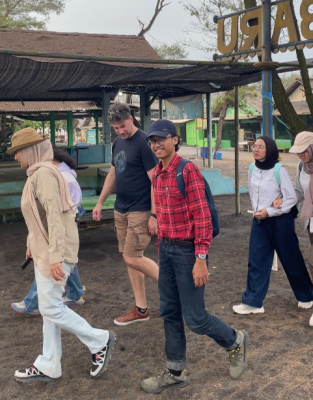
Yogyakarta – The Department of Geological Engineering, Faculty of Engineering, Universitas Gadjah Mada (DTGL FT UGM), together with Australia’s national science agency, the Commonwealth Scientific and Industrial Research Organisation (CSIRO), held a field visit for the Indonesian Water Accounting Program in the Progo River Basin on Wednesday, 11 November 2026. In a single day, the group followed the path of groundwater from a monitoring well on campus, to the regional groundwater management office, to monitoring wells in Bantul, and finally to the mouth of the Progo River on the southern coast.
The visit was attended by 24 participants. The CSIRO team was led by Project Director Dr Sreekanth Janardhanan, accompanied by a consultant from the University of Technology Sydney (UTS). Other participants came from DTGL UGM, the Serayu Opak River Basin Agency (BBWS Serayu Opak), the National Development Planning Agency (Bappenas), the Yogyakarta Public Works, Housing, and Energy and Mineral Resources Agency (Dinas PUP-ESDM DIY), and geography academics. The field visit is part of an Indonesia-Australia collaboration to develop groundwater accounting that supports modelling of the Yogyakarta-Sleman Groundwater Basin.
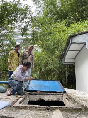
The group began at DTGL UGM with a visit to the GetIn-CICERO Laboratory, where they were introduced to the instruments used in geological and groundwater research. They then inspected the FT UGM monitoring well and the Umbul Kluwih spring, one of the natural springs within the Faculty of Engineering, UGM.

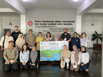
The trip continued to the Dinas PUP-ESDM DIY office. The group was welcomed by the Head of the Geological and Mineral Resources Section, Gusman Yusuf, S.T., M.T., for a discussion on groundwater monitoring and control. The discussion was also attended by Dr Aruminingsih, Coordinator of Raw Water Supply Systems, Directorate of Water Resources, Bappenas.
In its presentation, Dinas PUP-ESDM DIY explained that the province has 54 monitoring wells, 47 of which could be monitored in 2026, either through manual measurements or automatic water level recorders (AWLR). Groundwater decline is calculated as a percentage of aquifer thickness and classified under Yogyakarta Regional Regulation No. 5 of 2012. As of September 2026, all reported regencies and cities remained in the ‘safe’ category, with the highest value, about 10 per cent, recorded in Yogyakarta City. The agency also highlighted two control instruments: groundwater abstraction permits, and valuation through the Groundwater Acquisition Value as the basis for groundwater tax. Both instruments are intended to encourage more prudent groundwater use.
The presentation also stressed that “compliance of groundwater users with their permits will affect the condition of the aquifer in DIY”. For this reason, the tax is set in proportion to the volume of groundwater abstracted.
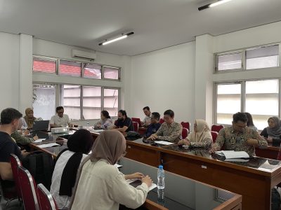
During the question and answer session, the agency explained that groundwater abstraction by businesses fluctuates with the holiday season, keeping the annual average under control. The agency also revisited the 2014 issue of groundwater levels dropping by up to 10 metres, which was linked to the rapid growth of hotel development.
The discussion also covered the seasonal pattern of groundwater levels, which fluctuate by about 5 metres between the dry and wet seasons. According to the speaker, irrigation water, whose primary and secondary networks are managed by BBWS and tertiary networks by local communities, influences groundwater levels more than rainfall does. The agency added that the central part of the groundwater basin responds more strongly to seasonal change. Because geological conditions and aquifer responses differ between areas, groundwater decline is analysed by regency and city.
Participants also discussed a former provincial rule requiring companies to build one monitoring well for every 10 hectares, which changed after permitting authority was transferred to the central government. The agency presents its monitoring results openly to the public and local stakeholders every November, and its annual report is publicly accessible.
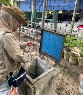
In the afternoon, the group travelled to Bantul Regency, accompanied by Gusman Yusuf. At the Wijirejo monitoring well in Pandak and the Gadingsari monitoring well in Sanden, the team measured groundwater depth and water quality parameters, including pH, electrical conductivity, and temperature. Groundwater at both wells was relatively shallow, about 2.6 to 4 metres below ground level. Participants also observed irrigation channels around Gadingsari, which, according to the agency, contribute to the rise and fall of groundwater levels.

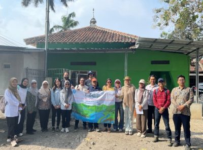
The measurements showed that groundwater at both wells is fresh, with pH of 7.8-8.5, electrical conductivity of 504-584 µS/cm, and temperatures of 29.8-31.7 °C. The groundwater depths measured by the team, about 2.6 metres at Gadingsari and 4 metres at Wijirejo, are consistent with the agency’s monitoring data for November 2026 of 2.66 metres and 4.21 metres.
The Dinas PUP-ESDM DIY presentation closed with a message that captures the spirit of the visit: “Groundwater is limited; our responsibility is not.” The message reflects the aim of the UGM-CSIRO collaboration: to provide reliable groundwater data and analysis for sustainable management.
Writers: Narulita Santi, Maya Aiko SP | Photos: Atha Dhimas P