

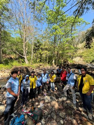
I conducted a three-week geological mapping project in Sojomerto Village, Kendal, together with four other student mappers and five field helpers. During the mapping activity, I observed outcrops, measured geological structures, and interpreted the distribution of rock units across my assigned area. Based on my field observations, I divided the area into three main lithological units, volcanic sandstone, calcareous siltstone, and volcanic breccia units. The volcanic sandstone unit is mainly distributed in the northern part of the area and is interpreted as part of the Damar Formation based on the regional geology. Distinguishing this unit from the volcanic breccia of the Kaligetas Formation in the southern area was challenging because both formations contain breccia. However, the occurrence of volcanic sandstone as a matrix and several volcanic sandstone outcrops supported my interpretation of the northern unit as the volcanic sandstone unit. In contrast, the southern area was classified as volcanic breccia because it is dominated by volcanic deposits associated with the Kaligetas Formation. Between these units, I identified a soft, fine-grained calcareous siltstone unit, particularly along rivers where erosion had exposed the underlying rocks.
Structural observations were also an important part of the mapping. Although I did not identify any faults, including minor faults, I observed numerous joints within the volcanic breccia unit. By measuring their orientations, I was able to analyse the direction of the geological forces or stresses that may have influenced the area. Beyond understanding its geological history, the resulting geological map can also provide useful information for the local community. The abundance of volcanic materials may contribute minerals to soils formed through weathering, which can support agricultural activities such as farming and gardening, although the actual suitability of the land would also depend on soil, slope, drainage, and other environmental conditions. Geological information can additionally provide an initial indication of ground conditions relevant to the planning of houses and other infrastructure, although detailed geotechnical investigation would still be required before construction.
This mapping activity can also contribute to the Sustainable Development Goals (SDGs) by demonstrating how geological knowledge can support sustainable use of local resources. In particular, it relates to SDG 2, Zero Hunger, as understanding volcanic-derived soils and local geology can help inform the identification and management of potentially productive agricultural land. It is also relevant to SDG 9, Industry, Innovation and Infrastructure and SDG 11, Sustainable Cities and Communities, because geological mapping provides baseline information that can support safer and more informed decisions about infrastructure development and land use. Through my experience in Sojomerto, I learned that geological mapping is not only about identifying rocks and reconstructing geological processes, but can also provide information that helps communities better understand and sustainably manage the land on which they live.
Author: Omar Mohammad Syaefullah
Humas Departemen | Oktober 2026