
Unveiling Geological History through Mapping
The Kulon Progo Mountains constitute an area within the Special Region of Yogyakarta characterized by diverse geology and fascinating landscapes. The hills found here are not merely the product of erosion and weathering but are the result of a series of geological processes spanning millions of years. The variety of rock formations exposed in Kulon Progo offers an opportunity to understand how the region’s geological environment has evolved over time. The presence of volcanic rocks, andesite intrusions, and carbonate rocks serves as evidence that the area once experienced magmatic and volcanic activity before transitioning into a shallow marine environment.
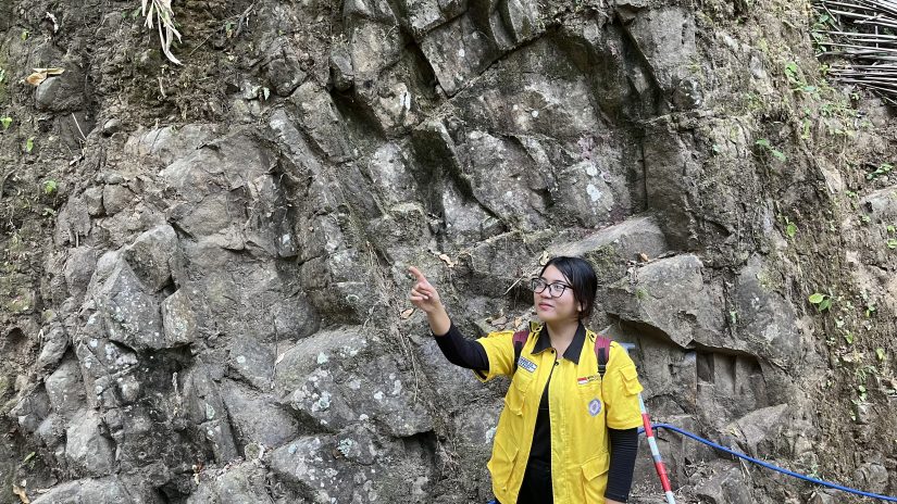
Through the 2026 Independent Geological Mapping initiative, direct observation of rock outcrops serves as a key method for reconstructing this history. Each outcrop discovered in the field provides information regarding rock types, formation processes, relationships between rock units, and the environmental conditions prevailing at the time of their formation.
Kulon Progo and Traces of Ancient Volcanism
One significant geological unit within the Kulon Progo Mountains is the Kebo-Butak Formation. This formation is dominated by volcanic rocks such as breccia, tuff, lapilli tuff, agglomerate, and andesite lava. These characteristics indicate that the Kulon Progo region was heavily influenced by volcanic activity in the past. The volcanic rocks found in the field serve as a record of ancient volcanic activity. Andesite fragments within the breccia, for instance, indicate the presence of volcanic material that underwent transport before being deposited. Meanwhile, the presence of andesite lava indicates that magma reached the surface and solidified.
Through geological mapping, the characteristics of these rocks ranging from color, texture, fragment size, and composition to their relationship with surrounding units can be directly observed. This information is then used to determine the distribution of rock units and to understand the geological processes that occurred. Thus, the volcanic rocks in Kulon Progo can be viewed as a record of the ancient volcanic activity that shaped the region prior to subsequent geological changes.
When Magma Penetrates Rock
Beyond surface volcanic activity, the history of magmatism in Kulon Progo is also evidenced by the presence of andesite intrusions. Unlike lava, which solidifies after reaching the surface, intrusive rocks form when magma penetrates pre-existing rock and solidifies beneath the Earth’s surface. Andesite intrusions can be identified by their rock characteristics, which are generally more massive and possess a crystalline texture. The relationship between the intrusion and the surrounding rock also provides crucial information for determining the sequence of geological events.
In geological mapping, the contact zone between the intrusive rock and the host rock is a feature of particular interest. This relationship reveals that the intrusion formed after the rock it penetrated. In other words, the presence of andesite intrusions serves as a vital piece of the puzzle in reconstructing the geological chronology of Kulon Progo. While the Kebo-Butak Formation reflects volcanic activity that developed in the region, the andesite intrusions demonstrate that the magmatic system operated not only at the surface but also beneath it.
From a Volcanic Setting to an Ancient Sea
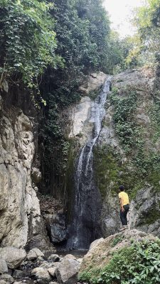
The geological history of Kulon Progo extends beyond mere volcanic and magmatic activity. Significant environmental changes are evidenced by the presence of the Jonggrangan Formation. The Jonggrangan Formation comprises a variety of rock types, ranging from clastic materials at the base to carbonate rocks at the top. The presence of limestone and coral limestone serves as a crucial indicator of the development of a shallow marine environment. These changes reflect a significant environmental transition. An area previously dominated by volcanic activity transformed into an environment conducive to the deposition of carbonate materials and the proliferation of marine organisms.
Coral limestone provides compelling evidence of these conditions. Carbonate-forming organisms require specific environmental conditions to grow; thus, their presence helps interpret past depositional environments. In this way, the rocks of Kulon Progo tell the story of a region’s evolution from a volcanically active zone into a shallow marine environment. This transformation is a vital component in reconstructing the geological history of the Kulon Progo Mountains.
Geological Mapping: Connecting the Pieces of the Story
Geological mapping is conducted to synthesize the various pieces of information gathered in the field. Observing a single outcrop is insufficient to understand an area’s geological conditions; data from multiple outcrops must be combined to determine the relationships between rock units. During mapping, data collected includes lithology, geological structures, bedding orientation, geomorphology, and stratigraphic relationships. This information is then used to construct geological maps and cross-sections.
Geological maps allow for the spatial visualization of the distribution of the Kebo-Butak Formation, andesite intrusions, the Jonggrangan Formation, and other rock units. Meanwhile, geological cross-sections illustrate vertical rock relationships and help estimate subsurface geological conditions. Consequently, geological mapping serves not merely as a means of identifying rocks, but as a method for reconstructing the geological evolution of a region.
Author: Danish Rafidan Subekti
Humas Departemen | Oktober 2026