
The 2026 Independent Geological Mapping Activity gave me an opportunity to directly understand the geological conditions of the Kulon Progo area. The mapping area consists of several geological units, including the Kebobutak Formation, Jonggrangan Formation, and a small occurrence of andesitic intrusion. In addition to its geological characteristics, the area also has several sites of fill-material mining activity.
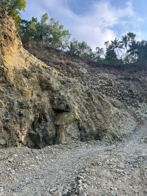
During the mapping activity, I observed rock outcrops, the distribution of geological units, and geological structures found in the field. One of the most interesting findings was a major dextral strike-slip fault. The structure shows a relatively consistent orientation in the Java Island and provides important information for understanding the deformation pattern that developed in the mapping area.

The presence of urugan mining sites also helped the mapping process because the exposed mining areas provided relatively good rock outcrops. These exposures made it easier to observe rock characteristics and geological structures. At the same time, mining activities show the importance of understanding local geological conditions when utilizing natural resources, particularly in considering slope stability, land conditions, and potential environmental impacts.
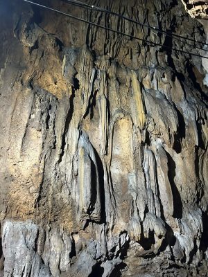
The landscape also revealed a cave containing numerous stalactites. Finding the cave during the mapping process was an unexpected but memorable experience. Inside, the presence of many stalactites showed how groundwater has interacted with the surrounding carbonate rocks over a long period of time, gradually forming these features. For me, the cave was a reminder that geological stories are not only found on the surface, but can also be hidden beneath our feet.
The results of the mapping are expected to provide an overview of the local geological conditions and serve as basic data for understanding the relationship between geology and human activities in the area. Although conducted at a student level, this activity trained me to connect field observations with real conditions in the surrounding community.
This activity is also related to several Sustainable Development Goals (SDGs), particularly SDG 9 on industry and infrastructure, SDG 11 on sustainable cities and communities, and SDG 12 on responsible consumption and production. Geological understanding can help support the appropriate utilization of natural resources while considering the geological characteristics of an area and its environmental conditions.
For me, this Independent Geological Mapping Activity was not only about creating a geological map, but also about learning how rocks, geological structures, mining activities, and the environment are interconnected. Conducting direct field observations in Kulon Progo helped me better understand that geological data collected in the field can play an important role in understanding and managing an area.
Author: Yudhistira Arya Putra Irfianto
Humas Departemen | Oktober 2026